

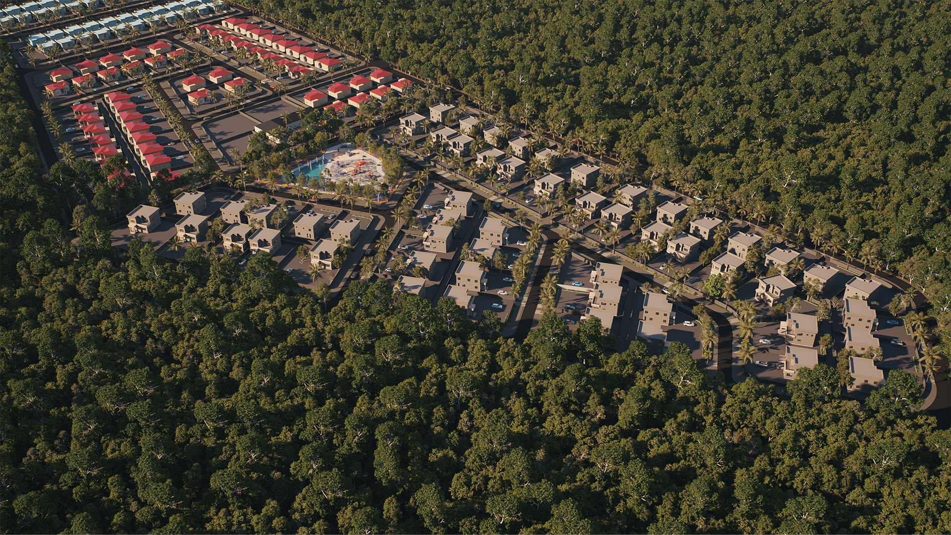
York Plantation Town Development presented a very different visualization challenge: how do you build a convincing digital representation of a new community when the project exists primarily as planning information, approved housing types, and a site within a large forested landscape?
The two-dimensional site plan had already been established by Guyana’s housing authorities, together with approved housing types and key planning elements such as roads, pedestrian routes and ramps. Persepolis Studio’s role was to translate this information into a complete three-dimensional environment for visualization, animation and interactive presentation.
The portion developed for the visualization represented approximately one-third of the wider York Plantation town development.
One of the first challenges was establishing the project accurately within its real-world context. The development sits within a largely undeveloped landscape near Linden, connected back toward the existing road network through a long access route. With limited dimensional site information available, satellite imagery, Google Earth references, and GIS tools were used to reconstruct the surrounding context and establish the relationship between the proposed development, its access road, and the existing landscape.
The housing itself presented another challenge. Each residential type needed to remain faithful to previously approved designs, yet the available architectural information was limited primarily to floor plans and façade references. The individual housing types were therefore reconstructed in 3D from this material before being distributed throughout the development according to the provided planning layout.
The park was the exception. While its location had been designated within the masterplan, its internal layout had not been developed. Persepolis Studio created the park concept and integrated it into the wider residential environment.
Scale became a major technical consideration. Hundreds of architectural and landscape elements had to coexist with an extensive surrounding environment and a large volume of vegetation. Scene optimization and controlled asset management were essential to keep the environment workable while retaining the density required to communicate the character of a community being developed within a heavily vegetated landscape.
Unlike a conventional visualization project, the process did not end with a set of still images. The complete environment was developed for multiple presentation formats, including architectural imagery, animation, and an online interactive tour.
The project also required an unusual revision workflow. Final presentation material was produced for review at government and presidential levels, after which revisions were incorporated into the project. This cycle occurred three times, requiring the visualization environment to remain consistent and manageable across updated renders, animation, and the interactive experience.
The result was not simply a collection of images, but a reusable digital environment capable of communicating the proposed development at multiple scales—from individual housing types and public spaces to the broader relationship between the new community and its surrounding landscape.