
Journal · Guyana · 2026

The Kurupukari Bridge

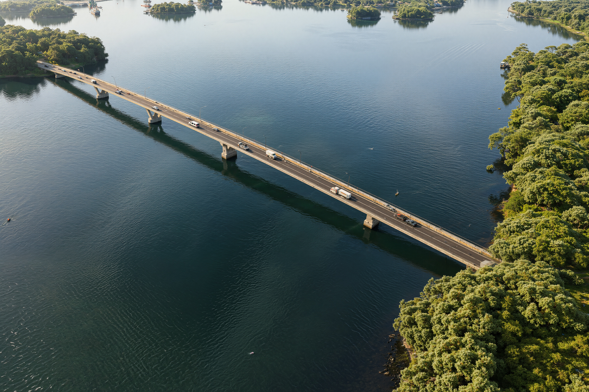
Four bridge concepts developed within one large-scale digital environment, combining site context, detailed 3D modeling, visualization and animation to clearly communicate each alternative.

The Kurupukari Bridge project presented a visualization challenge that extended far beyond producing a series of final images.

The objective was to develop and communicate four different bridge concepts for the same crossing in Guyana, allowing each alternative to be understood and compared within a consistent visual context.

Persepolis Studio worked across the project from bridge concept development and detailed 3D modeling to large-scale environment creation, architectural visualization, and animation.

The process began with the existing Kurupukari crossing and its surrounding landscape. Site references and terrain data were used to build a shared digital environment, establishing a consistent foundation for the development and presentation of each bridge alternative.

Four concepts were developed and visualized: Box Girder, Steel Girder, Extradosed, and Cable-Stayed.

Rather than treating each proposal as an isolated visualization, the same environmental context, site conditions, and visual language were maintained across the alternatives. This made it possible to evaluate each concept not only as a structure, but as part of the wider landscape and crossing.

The resulting visual system was used across still imagery and animation, creating a consistent presentation framework for communicating the scale, character and differences between the proposed bridge concepts.

Film & Animation

The Bridge in Motion

Static images establish key views, but animation reveals the scale of the crossing in a different way. The architectural film moves through the project environment to show the relationship between the bridge, river and surrounding landscape while presenting the proposal as part of a much larger infrastructure context.

Process

From Site Data to Digital Environment

The visualization process began with the existing Kurupukari crossing and its surrounding landscape. Site references and terrain data were translated into a large-scale digital environment, providing a consistent foundation for bridge development, visualization and animation. Detailed bridge geometry, roadway elements, piers and surrounding terrain were developed within the same 3D environment, allowing the project to be studied and presented from both technical and large-scale visual perspectives.

Final Experience

Final Visualizations

The final imagery was developed to communicate the bridge at multiple scales—from views focused on the structure itself to wider perspectives showing its relationship with the river and surrounding landscape. Together, the images create a consistent visual narrative of the crossing and its broader environment.

Start a conversation

Let's talk about your project.

Tell us what you're planning. We usually reply within a few hours, with first thoughts on approach and timeline.